The Fleet Below Your Feet: A Source-to-Thames Walk Through London's Lost River
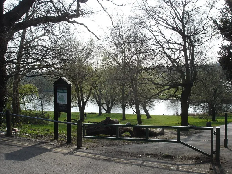
Photo: Julian Walker from Bethnal Green & Torquay, CC BY 2.0, via Wikimedia Commons
The River Fleet is London's best-known secret. You can't see it for most of its length, but you can feel it in the names — Fleet Road, Fleet Street, the dip in the road at King's Cross — and on a wet weekend you can sometimes hear it rushing under metal grilles. This walk follows the lost river from its Hampstead beginnings to the point where it slips into the Thames at Blackfriars. It is about seven miles, mostly flat after the first descent from the heath, and takes three and a half to four and a half hours with pub stops. Download the Best LDN Walks Fleet route map before you go; the streets are straightforward, but the river's line is not always obvious.
Before you set off
Start at Whitestone Pond on Hampstead Heath, reachable from Hampstead Underground. Wear shoes you don't mind getting muddy, bring a charged phone and carry a bottle of water. The Fleet is a fair-weather friend: after heavy rain, the sewers and culverts that carry it can back up, and you may see water swirling at grates. Do not go hunting in basements or lifting drain covers. This is a street-level walk, not a sewage safari. The downloadable map includes bail-out points at Kentish Town, King's Cross and Farringdon if your legs or the weather give out.
Stage 1: Hampstead's damp beginning
The Fleet begins as a collection of springs and ponds on the heath. Whitestone Pond is the traditional starting point, though the truth is more scattered: the river's headwaters once fed a chain of ponds and boggy hollows across this high ground. From the pond, head down Heath Street into Hampstead village. The old river ran east of the High Street, but a sensible street route drops through the village towards Gospel Oak, where Fleet Road gives the game away. This is the only proper climb of the day, and it is all downhill from here. If you need fortifying before the descent, The Flask on Flask Walk is a good old-fashioned Hampstead pub with a beer garden and no pretence.
Stage 2: Camden, Kentish Town and the Victorian underworld
From Gospel Oak, follow the general line of the river east and south towards Kentish Town. The Fleet once powered mills and supplied water; by the 19th century it had become an open sewer, a byword for everything Victorian London wanted to hide. Joseph Bazalgette's intercepting sewers swallowed it whole, turning the river into a buried storm relief channel. You are walking above one of the great engineering projects of the age, even if the evidence is mostly manhole covers and the occasional grille. Pause at The Bull & Gate on Kentish Town Road — a proper Kentish Town boozer — and look for the slight valley in the streets, a ghostly hint of the river's old course.
Stage 3: King's Cross and Clerkenwell
Continue south towards King's Cross. The Fleet runs beneath Pancras Road and King's Cross Road, and after heavy rain you can sometimes hear it muttering below. Roman Londoners used the Fleet as a water source and a boundary; later, the river marked parish edges and property lines. At Clerkenwell, the water passed the medieval priory of St John, whose gatehouse still stands on St John's Lane. This is also the stretch where modern campaigns to 'daylight' the Fleet gather most noise. Small openings and storm events occasionally reveal the river, and the idea of bringing it back above ground has a stubborn romantic appeal. Stop at The Betsey Trotwood on Farringdon Road for a pint and a look at the brickwork.
Stage 4: Fleet Street and Blackfriars
Fleet Street takes its name from the river, which once formed a boundary between the City and Westminster. By the time you reach Farringdon, you are following the valley into the old print district. The river became a notorious sewer here, and the Victorians covered it with the same confidence that built the Embankment. Walk down to Blackfriars Bridge, where the Fleet empties into the Thames through a culvert. It is an unglamorous end to a grand walk: a concrete edge, a rush of traffic, and the Thames doing its wide, brown thing. The Blackfriar pub, tucked beside Blackfriars Bridge, is the obvious place to raise a glass to a river you have mostly not seen.
Practical notes
The route is about seven miles and should take four hours at a gentle pace, longer with pub stops. There are toilets at Hampstead Heath, King's Cross and Blackfriars. The walk is mostly on pavements and signed streets, but the Fleet's exact line is often invisible, so use the Best LDN Walks printable map and keep an eye on the road names. Best done on a dry weekend after a wet week, when the ghost river is at its most vocal. Finish at Blackfriars station for Thameslink, District and Circle line connections.