Frozen Carnivals: A Thames Path Walk Through London's Frost Fair Winters
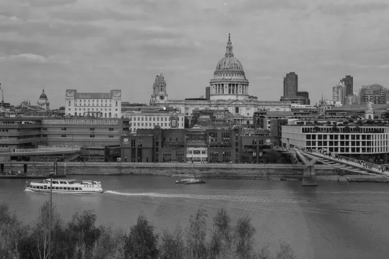
Winter in London is usually a damp negotiation: drizzle, dark pavements, a bus that arrives late. But the river has a stranger past. Between the sixteenth and nineteenth centuries, the Thames sometimes froze hard enough to carry crowds, and London did what London does with an emergency — it turned it into a party. The Frost Fairs were part carnival, part market, part news event. This walk follows the north bank from London Bridge to Blackfriars, using the modern embankment as a detective trail through that frozen history.
Allow about ninety minutes for the walking, longer if you stop to read every plaque and peer at every water stair. It is best done on a cold, clear morning when the river has that grey-metal shine and the city feels briefly honest about its weather.
Start at London Bridge: where the old bridge made the ice
Leave London Bridge station on the north side and head for the riverside path below the bridge. If the tide is high or a gate is closed, follow Upper Thames Street west and rejoin the river at Queenhithe. The route is signed as part of the Thames Path in places, but it is not a continuous promenade; you will weave between riverside terraces, main roads and City backstreets. That is part of the point. The frozen past is not laid out for tourists.
The first thing to understand is that the old London Bridge did much of the freezing. Its narrow arches acted like a dam, slowing the current and letting ice collect upstream. In the Little Ice Age — roughly the fourteenth to the nineteenth century — cold winters were more frequent, and the combination of sluggish water and hard frost could produce ice thick enough to walk on. The famous fairs of 1683–84, 1716, 1739–40 and 1814 were not everyday events. They were exceptional winters that became public theatre.
Stand where you can see the river and imagine the old bridge a little downstream of today's crossing. The medieval bridge was demolished in 1831, and the Victorian embankments came later. Both changed the river's speed and shape. The Thames you see now is a tidier, faster, walled-in river. It is also why the Frost Fairs ended.
Reading the embankment for frozen clues
There is no surviving Frost Fair pavilion, no ice-market plaque on every corner. What survives is subtler: the river's width, the line of the walls, the old water stairs, the way the City turns its back and then suddenly opens to the water. Look for stone courses, mooring rings, sluices and the small stairways that once led down to working riverboats. The embankment is Victorian engineering dressed as public amenity, and it deliberately erased much of the messy, tidal shoreline that froze.
Use old prints as your guide. The best-known images show tents, flags, printing presses and crowds between London Bridge and Westminster. You can find them in the London Metropolitan Archives, the London Picture Archive and the Museum of London's online collections. Carry one on your phone and compare the curve of the river. The fairgrounds were not in some distant rural reach; they were here, in the middle of the commercial city.
Queenhithe and the lost fairground
Queenhithe is one of the quietest, oddest stops on the route. It is a historic dock, a scheduled ancient monument and a reminder that the river was London's working front door long before it was a view. In Frost Fair years, the ice between the old bridge and Westminster became a temporary high street. Booths sold ale and gingerbread; printers set up presses on the ice and sold souvenir sheets with the words 'printed on the River Thames'. In 1814, the last fair, a sheep was roasted, an elephant was led across the ice, and Londoners took home printed keepsakes as if the river had become a novelty postcard.
Pause here and look west. The Millennium Bridge and Blackfriars Bridge are modern landmarks, but the essential geography is old: a broad bend, a narrowing channel, a city pressed close to the water. The Frost Fairs happened in this corridor. They were not romantic, exactly. They were cold, smoky, crowded and probably smelled of animals, coal and beer. But they were also a defiant bit of collective imagination.
The last fair and the river that refused
The 1814 fair is the one to keep in mind. It came late in the Little Ice Age, and it was the last of its kind. By then the old bridge was about to go, and the Victorian embankments would soon narrow and straighten the river. A faster, deeper channel freezes less readily. Add milder winters and the modern urban heat of a growing city, and the carnival on the ice becomes impossible. In 2026 the Thames still has a tidal pulse and a cold January bite, but it does not stop for crowds.
That absence is the story. The Frost Fairs survive as engravings, pub names, local legends and the occasional interpretation board along the Thames Path. They survive in the way London often keeps history: not as a monument but as a rumour attached to a place.
Practical notes
Start: London Bridge station, north-bank exit. Finish: Blackfriars station. Distance: about 2.5 miles. Time: 90 minutes to two hours. Terrain: pavement, riverside paths, a few road crossings and steps. Check the tide and river-path closures before setting out; high water can shut lower sections. Wear shoes that can handle wet stone. For a pub stop, look around Queenhithe and Blackfriars rather than the main-road chains. And bring an old Frost Fair print on your phone — it turns a ordinary winter walk into a conversation with the ice.