The Tracks That Refuse to Disappear: A Brixton to Crystal Palace Tram Walk
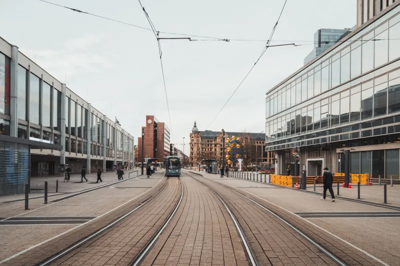
London is good at burying its infrastructure. It paints over it, paves it, builds a bus lane on top and hopes nobody asks awkward questions. South London’s tram network is a fine example. The trams are gone, but the streets they made — and the scars they left — are still there, waiting for a curious pair of eyes and a decent pair of shoes.
This walk runs from Brixton to Crystal Palace, following one of the old tram corridors south of the river. It is not a museum tour. There are no turnstiles, no laminated panels and no gift shop. The evidence is in the road surface, the shape of junctions, the width of pavements and the odd wall that looks as if it once had a more industrial purpose.
Route at a glance
- Start: Brixton station (London Underground and National Rail)
- Finish: Crystal Palace station (London Overground and National Rail)
- Distance: about 5.5 miles
- Time: 2.5 to 3.5 hours, depending on how often you stop to stare at tarmac
- Terrain: mostly pavement, with a steady climb towards Crystal Palace
- Best time: a dry weekend morning, before the high road gets busy
- Route map: Brixton station → Brixton Hill → Streatham Hill → West Norwood → Gipsy Hill → Crystal Palace Park → Crystal Palace station
What you are actually looking for
Tram traces are subtle. You will not find a pristine rails-and-cobbles set piece on every corner. What you will find are clues: short stretches of metal set into the road, old setts peeking through worn asphalt, boundary walls with depot-scale brickwork, wide forecourts that look oddly generous for modern traffic, and pub names or signs that keep the old routes in local memory.
The trick is to look down as well as up. At junctions, watch for parallel lines in the tarmac. Near older shopping parades, look for shelters or canopies that seem too shallow for a bus. And on the hills, notice how the road widens and narrows — tram routes needed room, and the streets often still carry that generous geometry.
Brixton to Streatham Hill: the first clues
Begin at Brixton station and head south up Brixton Hill. This is not a quiet start, but it is a useful one. The road is broad, the pavements are wide and the whole corridor has the feel of a route built for serious movement rather than casual strolling.
Keep an eye on the edges of the carriageway. In places, the road surface has been patched so many times that older layers show through. A short line of metal, a strip of stone, a change in texture underfoot — these are the kinds of details that reward a slow pace. Do not stand in the road to inspect them. Use crossings, look both ways and remember that the modern traffic is not remotely interested in your historical research.
As you climb towards Streatham Hill, the street becomes more residential and the tram-era logic becomes easier to read. The route follows a long, steady ridge, linking one shopping stretch to the next. Trams did not just serve these suburbs; they helped create them. Cheap, frequent electric travel made it possible to live further out and still reach the centre for work, shopping or a night out.
Streatham to West Norwood: depot walls and old rhythms
Carry on through Streatham Hill and down towards West Norwood. This middle section is where the walk starts to feel less like a main-road slog and more like a detective story. Look for large brick walls and wide entrances that seem out of proportion to the buildings around them. Some may be old industrial or transport boundaries; others are simply the kind of robust Victorian and Edwardian structures that trams, buses and depots tended to leave behind.
You are also walking through a landscape shaped by the tram timetable. The parades of shops, the pubs on corners, the churches and the clusters of housing all sit in relation to the old route. When the trams went, the roads did not reset. The suburbs kept their tram-shaped bones.
Why did the tracks vanish? London’s tram network was huge in the early twentieth century, but the writing was on the wall by the 1930s. Buses were flexible, diesel was becoming the norm and tram tracks were expensive to maintain. London’s last tram ran in 1952. In many places, the rails were simply covered over rather than torn out — which is why, decades later, roadworks can still expose a surprising length of old metal.
Gipsy Hill to Crystal Palace: the climb and the payoff
From West Norwood, continue south and begin the climb towards Gipsy Hill and Crystal Palace. This is the most rewarding part of the walk. The road narrows, the gradients bite and the sense of leaving the inner city behind becomes stronger with every few hundred metres.
Crystal Palace is a fitting endpoint. The palace itself burned down in 1936, but the area around it remained a major transport destination. Trams once helped bring crowds up to the park and the palace grounds. Today, the park is a good place to pause, rest your legs and look back over the route you have just walked. From the higher ground, the long ridge from Brixton to here makes a certain kind of sense: a corridor of movement, stitched together by rails that most people have forgotten.
Finish at Crystal Palace station, or extend your walk into the park if the weather is behaving. Either way, you have just followed a piece of hidden infrastructure from one end of South London to the other — without buying a ticket or reading a single interpretation board.
Practical notes for weekend walkers
Wear comfortable shoes; the pavements are mostly good, but the climb is real. Take water and a charged phone. Cross roads at proper crossings, especially on the busier sections around Brixton and Streatham. If you want to make a day of it, stop for lunch around West Norwood or push on to Crystal Palace, where there are plenty of cafés and pubs near the station.
And keep looking down. The trams are gone, but the road still remembers them.