The Pavement’s Iron Archive: A Covent Garden to Fitzrovia Coal-Hole Cover Walk
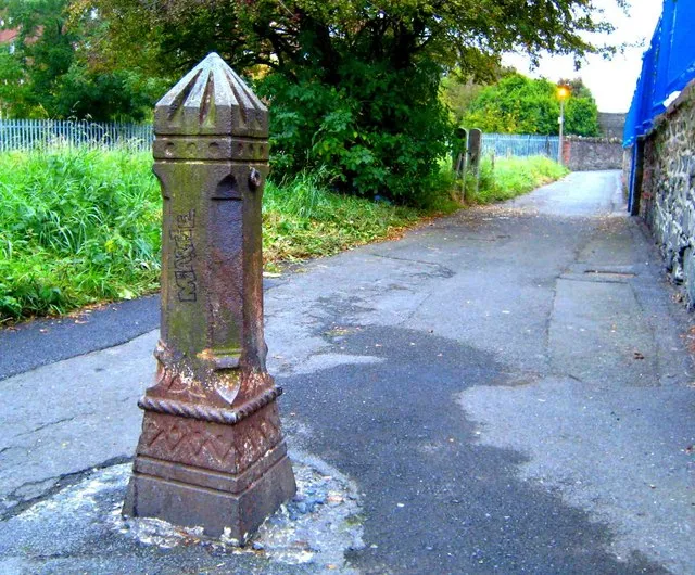
Photo: Ross, CC BY-SA 2.0, via Wikimedia Commons
Most London walks ask you to look up at spires, cornices or old shop signs. This one asks you to look down — not in a gloomy, avoid-the-pavement-cracks way, but in a properly curious, what-on-earth-is-that-iron-plate way. Between Covent Garden and Fitzrovia there is a scattered archive underfoot: coal-hole covers, those small cast-iron lids that once topped the chutes into basement coal cellars. They are easy to miss, which is half the pleasure. Once you start spotting them, they turn an ordinary pavement into a Victorian service map.
Start at Covent Garden: Look Down Before You Look Up
Begin on the eastern side of Covent Garden Piazza, near the market building, and work your way north and west rather than straight into the tourist scrum. The piazza itself is not exactly a coal-hole hotspot — too much rebuilding, too many crowds — but the side streets around Neal Street, Monmouth Street and Earlham Street reward a slow, deliberate look at the ground.
Coal-hole covers are not uniform. Some are plain, almost apologetic rectangles. Others are decorated with sunbursts, grids, diamonds or concentric rings. The pattern was partly practical — grip for boots and ventilation for the cellar — and partly a bit of Victorian shop-window pride applied to the pavement. A coal merchant’s plate could advertise good ironwork as surely as a painted fascia board.
Walk north up Neal Street and keep to the edges of the pavement, where covers are less likely to be covered by crowds or café furniture. You are looking for a flush iron plate, usually square or rectangular, sometimes round, set into the paving. Many are now surrounded by tarmac patches or newer stone, which is a clue in itself: the cover survived, but the pavement around it has been chopped and changed.
Seven Dials and the Grammar of Iron
At Seven Dials, pause where the streets fork. This is a good place to get your eye in. The covers here are a mixed bunch — some Victorian, some later replacements, some perhaps not coal holes at all but access plates for drains, gas or water. That ambiguity is part of the fun. You are not looking for a museum exhibit; you are reading a working pavement that has been repaired, rewired and dug up for more than a century.
Look for makers’ marks around the rim. Names such as Hayward Brothers, a Borough-based ironfounder, turn up on London coal plates, though you will also see plenty of anonymous or badly worn examples. Some carry the word “coal” or a date; many carry nothing legible at all. A worn pattern is its own record. Iron that has been walked over by generations of boots, barrows and heels goes smooth in the middle and sharp at the edges.
From Seven Dials, head west along Shaftesbury Avenue and then slip into the smaller streets of Soho. Dean Street and Wardour Street are busy, but the side turnings — Meard Street, for instance — are quieter and more rewarding for close looking. Basement kitchens, old service entrances and pavement grilles all belong to the same domestic machinery. The coal hole was simply the delivery end of it.
Soho’s Service Streets
In Soho, the coal-hole cover becomes a clue to how densely packed domestic London once was. Terraces of houses had basement coal cellars, and coalmen would tip sacks down the chute rather than carry them through the front hall. The cover kept the pavement safe and the cellar ventilated. It also meant that a seemingly ordinary Georgian or Victorian house had a small industrial supply line running under the pavement.
As you walk, notice where covers cluster. They often appear outside former houses rather than shops, or where a building has been converted but its basement level remains. Look for nearby basement lightwells, low iron railings and old stone steps. These are the supporting cast. A coal hole without a cellar below is just a metal plate; with a cellar, it becomes a small piece of household logistics.
Cross Regent Street with care and continue towards Oxford Street. You do not need to walk the full length of the big shopping street — a short stretch is enough — but use it as a boundary crossing. North of Oxford Street, the streetscape changes again: Fitzrovia’s grid of Charlotte Street, Rathbone Street and Goodge Street has a quieter, more residential feel, with plenty of conversions and basement levels.
Fitzrovia’s Basement Kitchens
Charlotte Street and its neighbours are good for the final stretch. Here the covers are often set into narrower pavements, which makes them easier to examine without blocking anyone’s path. Step to the side, let people pass, and look for the small details: a maker’s name picked out in raised lettering, a ring of studs for grip, a cover that has been reset at a slightly crooked angle after a pavement repair.
This is also where you notice the difference between a coal-hole cover and a general utility cover. Coal plates tend to sit close to the building line, often just outside a front wall or basement railing. Drain covers are more likely to sit mid-pavement. Neither rule is absolute, but the pattern helps you read the street. The old service geography is still there, just buried under decades of resurfacing and redevelopment.
Finish near Goodge Street station, where the pavements are busy but the side streets are not. If you have time, loop back along Rathbone Street and look at the ironwork near basement entrances. The covers may be rusted, painted over or half-hidden by bins, but they are still doing a job: covering a hole, bearing weight, reminding anyone who looks that London’s domestic past was fuelled by coal and organised through small iron plates.
What to Look For — and What Not to Do
Look, don’t lift. These covers are part of the public pavement and should stay put. Avoid standing in the middle of busy crossings, and never crouch down in a way that blocks a doorway or forces pedestrians into the road. A quick pause at the kerb is enough. Photography is best in flat, overcast light, when the raised lettering casts a small shadow.
Useful things to notice: makers’ names, date stamps, patterns, repairs, replacement covers, nearby basement railings and the way covers cluster outside former houses. Less useful: trying to date every single plate. Some are Victorian, some Edwardian, some modern reproductions. The pleasure is in the looking, not in turning the walk into an exam.
The Route at a Glance
Start: Covent Garden Piazza. Finish: Goodge Street station. Time: about two hours at a gentle pace, with pauses. Route: Covent Garden — Neal Street — Seven Dials — Shaftesbury Avenue — Soho side streets — Oxford Street crossing — Charlotte Street — Rathbone Street — Goodge Street. Best for: a dry weekend morning, when the pavement is not slick and the streets are not yet packed. Bring: comfortable shoes, a phone camera and a willingness to look down. The iron archive is free, open all hours and almost entirely overlooked.